GPS Tracking. Predictive Maintenance. Zero Blind Spots.
From a single motorcycle courier to a two-hundred-unit locomotive network, Kendaall Tracking gives fleet operators one continuous view of every vehicle they run: live position, engine health, fuel level, driver conduct, and asset security, all inside one dashboard. Twelve-plus asset classes. One platform. Every kilometre accounted for.
Book a Demo Speak to a Specialist
 Live Network Monitor
Vehicle Tracking in Kenya Has Changed. Most Providers Haven’t.
Kenya’s fleet management market has grown quickly, yet most GPS tracking providers still sell what they sold a decade ago: a device that reports where a vehicle was, some minutes after the fact. A dot on a map. An address log emailed at midnight. That is a record, not an answer. It tells an operator where a truck has been. It says nothing about whether the truck is about to break down, whether the driver behind the wheel is a liability, or whether last night’s fuel reading matches what actually left the depot.
Kendaall Tracking was built on a different premise: real-time position is the entry point, not the product. The product is what happens once that position feed is layered with continuous engine telemetry, driver behaviour analysis, fuel-level monitoring, predictive failure modelling, and operational analytics, delivered through one dashboard that works whether an operator runs three motorbikes or two hundred lorries.
The gap most fleet managers actually feel is not between having GPS and not having GPS — almost every commercial fleet in Kenya has some form of tracking today. The real gap sits between knowing where an asset is and understanding what it is doing, how efficiently, at what cost, and whether a breakdown is three days away. Closing that gap, across every asset class, every corridor, and every connectivity environment an operation runs through, is the entire reason Kendaall exists.
Kenya also records one of the higher road-fatality burdens in the region — the National Transport and Safety Authority recorded 4,458 road deaths in 2025, a rise from 4,311 the year before, with pedestrians and motorcyclists the most exposed groups. That backdrop is part of why several of the services below exist, not as an afterthought to fleet efficiency, but as a direct response to it.
Six Services. One Unified Intelligence Layer.
Every Kendaall capability is designed to reinforce the others. Real-time tracking data feeds the predictive maintenance model. Predictive alerts trigger CMMS work orders through the integration layer. Fuel data informs driver behaviour reports, and behaviour data feeds back into insurance and safety reporting. An operator activates one interconnected intelligence system, not six separate add-ons competing for attention.
Real-Time GPS Vehicle Tracking
Sub-30-second position updates via multi-constellation GNSS and multi-network radio. Works across Kenya’s urban corridors, remote farmland, and cross-border freight routes from Mombasa to Kampala.
- GPS, GLONASS, Galileo, BeiDou multi-constellation
- Configurable geofences with real-time breach alerts
- 90-day historical route replay on all plans
- Inertial dead-reckoning during signal loss
Predictive Maintenance
Machine learning failure prediction that delivers 72–120 hour advance warnings across vibration, thermal, oil quality, and duty-cycle data. Reduces unplanned downtime by 38% on average within the first year.
- Vibration spectral analysis for rotating machinery
- Thermal gradient anomaly detection
- Automated CMMS work order generation
- Component-level health scoring per asset
Fuel Monitoring & Theft Detection
Real-time fuel level tracking via BLE dipstick sensor and CAN bus integration. Detects siphoning on parked vehicles, cargo tank partial offloads on tankers, and excess idle consumption.
- BLE dipstick sensor for tank level monitoring
- Tanker partial-offload theft detection
- Idle time reporting and excess idle alerts
- Fuel efficiency benchmarking per driver/route
Driver Behaviour & Safety Scoring
Daily performance scoring across hard braking, harsh cornering, speeding, and fatigue patterns using accelerometer and gyroscope data. Fleet-wide rankings surface drivers who need coaching before an incident.
- Per-driver daily scores with trend history
- Crash detection and emergency alert dispatch
- Fatigue pattern identification over long shifts
- Coaching trigger reports for HR integration
Asset Security & Theft Recovery
Multi-layer geofencing, tamper-detection switches, concealed secondary beacons, and real-time recovery coordination — effective from a bicycle to a locomotive.
- After-hours ignition and movement alerts
- Concealed secondary beacon for recovery backup
- National boundary and corridor geofencing
- Law enforcement recovery data package
Fleet Analytics & ERP Integration
Automated performance benchmarking, utilisation reporting, GHG Protocol Scope 1 emissions documentation, and native two-way connectors for SAP PM, Oracle, IBM Maximo, and IFS — live within 48 hours.
- SAP PM, Oracle, Maximo, IFS native connectors
- REST API with Python, JS, Java SDK libraries
- GHG Protocol Scope 1 emissions reporting
- 5-year data retention for regulatory compliance
Tracking Devices Built for Africa’s Roads and Networks
Most GPS tracking devices are designed for temperate climates with dependable cellular infrastructure. Kenya’s operating environment is different: extreme heat, dust, unpaved routes, and cellular dead zones across the Northern Corridor, the Rift Valley, and the cross-border freight routes into Uganda, Tanzania, and South Sudan. Hardware that has not been engineered for that environment fails exactly where fleets need it most — out of signal range, on rough roads, far from a workshop.
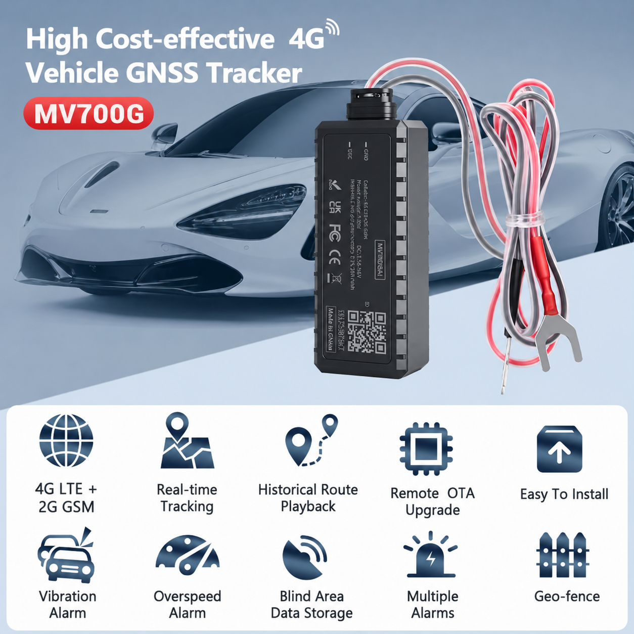
Kendaall’s 4G LTE tracking units are built specifically for these conditions: IP67/IP68-rated enclosures, an operating range of −40°C to +85°C, and native SAE J1939 and OBD-II interfaces. Every device connects directly to the vehicle’s CAN bus, reading more than 180 engine and transmission parameters in real time rather than inferring them from position data alone.
The BLE fuel sensor module fits directly to the dipstick or in-tank float to deliver continuous fuel-level readings — still one of the most reliable methods available for fuel theft detection on lorries, tankers, and construction equipment operating across Kenya’s logistics corridors.
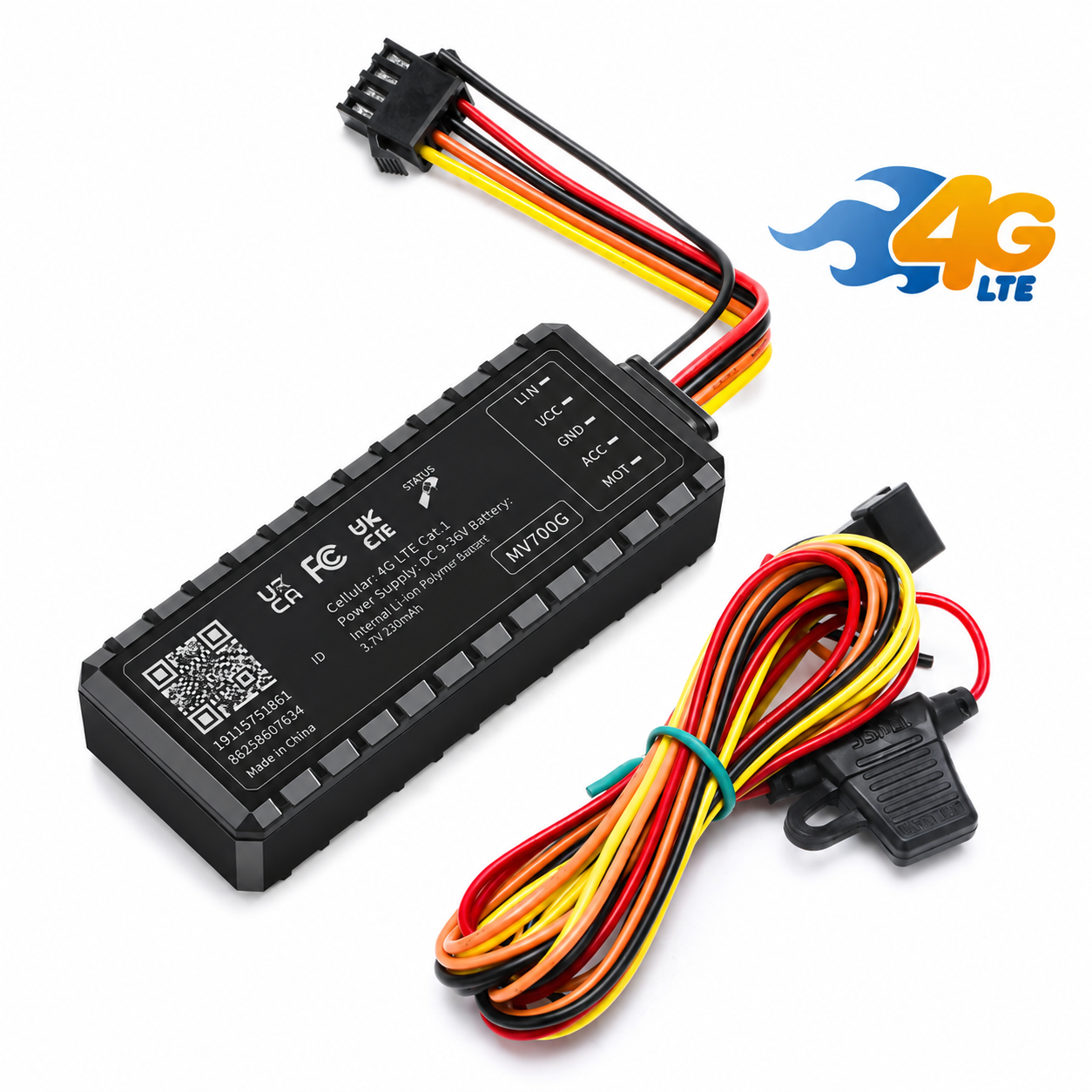
4G LTE tracker range — hardware behind every service above.
Vehicle tracker

BLE fuel sensor
The Foundation Layer Every Other Service Sits On
Position data looks like the simplest thing Kendaall provides, and in one sense it is — a dot on a map is easy to understand. But that dot is also the input every other Kendaall service depends on. Predictive maintenance models need to know duty cycle and terrain. Fuel theft detection needs to correlate a fuel drop with whether the vehicle was moving or parked. Driver scoring needs route and speed context. None of that works without a tracking layer that is accurate, frequent, and resilient to the connectivity gaps that define large parts of Kenya and its neighbours.
Kendaall’s tracking layer updates position in under 30 seconds using simultaneous GPS, GLONASS, Galileo, and BeiDou signals, so a single blocked constellation — common under dense forest canopy, in urban canyons, or near mining pits — does not blank the feed. When a vehicle enters a genuine dead zone, on-device inertial dead-reckoning estimates position from the last known heading and speed until the signal returns, rather than simply going dark on the dashboard.
Every asset carries 90 days of historical route replay by default, which matters for more than curiosity: it is what lets a fleet manager reconstruct exactly what happened before an incident, verify a delivery route against a client’s complaint, or produce a clean audit trail for a corridor permit.
- Sub-30-second position refresh on every plan, no premium tier required
- Four-constellation GNSS for resilience under canopy, in urban canyons, and near heavy plant
- Inertial dead-reckoning bridges genuine signal loss without breaking the timeline
- Configurable geofences that other Kendaall services — security, driver behaviour, analytics — reuse automatically
Position refresh, all plans
Route history retained
GNSS constellations used
Geofence breach alert

Predictive maintenance AI — up to 120 hours of advance warning.
Max advance warning
Downtime reduction
Know About the Breakdown Before It Happens
Unplanned breakdowns on Kenya’s major freight corridors — the Northern Corridor, LAPSSET, and the Standard Gauge Railway — cost operators anywhere from KES 45,000 to KES 280,000 per incident once crew reallocation, emergency towing, delay penalties, and lost haul revenue are added together. The pattern is almost always the same: the failure was not sudden. The warning signs were there. Nobody was reading them, because nobody was collecting them in a form that could be read.
Kendaall’s predictive maintenance engine runs ensemble machine learning models trained on more than 2 million asset-hours of failure data. It watches vibration frequency signatures, thermal gradients, engine oil quality indicators pulled over the CAN bus, brake system pressure patterns, and acoustic emission data from rotating components, building a continuous health profile for every monitored asset that updates as the vehicle operates rather than at scheduled service intervals.
When the model identifies a developing fault, it issues a maintenance alert with 72 to 120 hours of advance notice — enough time to schedule a planned stop, position a technician, and procure the part, instead of discovering the failure on the shoulder of a highway at 2am.
- Traction motor temperature and insulation monitoring for locomotives
- Wheel-set wear estimation via vibration spectral analysis
- False positive reduction of 73% within 90 days of deployment
- Automated work order generation direct to CMMS
Fuel Theft Is Costing Your Fleet More Than You Think
Fuel theft from commercial vehicles in Kenya accounts for an estimated 12–18% of total fleet fuel expenditure for operators running without active monitoring. It happens three ways: siphoning from parked vehicles overnight, driver skimming disguised as falsified mileage claims, and partial offloading from tankers mid-route. None of these three methods is detectable without continuous, real-time visibility into what is actually in the tank, as opposed to what the trip sheet says should be there.
Kendaall’s BLE fuel sensor fits directly to the vehicle’s tank via the dipstick port or in-tank float, sending readings to the live dashboard every 30 seconds. Any sudden, unexplained fuel drop — whether the vehicle is moving or stationary — generates an immediate alert with a timestamped GPS location and the driver ID attached to that vehicle at the time.
For tanker operators, Kendaall’s cargo tank monitoring extends the same principle to the load itself, not just the vehicle’s own fuel supply. Operators running Kenya’s petroleum distribution corridors report recovering between 8% and 14% of total fuel volume within the first 90 days of deployment, simply by making theft visible where it was previously invisible.
- 30-second fuel level updates via BLE sensor on all vehicle types
- Siphoning detection on parked and overnight vehicles
- Cargo tank partial offload detection on tanker operations
- Excess idle consumption reporting with driver attribution
- Route-level fuel efficiency benchmarking across all drivers
BLE fuel sensor — real-time, 30-second refresh.

Fleet-wide safety dashboard — every driver scored daily.
Top fleet driver score
Accident rate reduction
Insurance premium saving
Scoring frequency
Driver Behaviour Monitoring That Reduces Accidents and Insurance Costs
Kenya carries one of the higher road-fatality burdens in the region, and commercial vehicles are disproportionately involved in the most severe crashes. For a fleet operator, that reality creates both a duty of care toward drivers and the public, and a direct financial exposure through liability claims, cargo loss, vehicle write-offs, and rising insurance premiums.
Kendaall’s driver behaviour module uses a three-axis accelerometer and gyroscope to score every driver, every day, across hard braking frequency, harsh cornering, speed compliance, and route adherence. Each driver receives a daily score between 0 and 100, and fleet managers see the full ranking, so the highest-risk drivers are visible immediately rather than surfacing only after an incident report.
The system is also built to catch fatigue patterns before a driver becomes a liability — irregular braking rhythms and drifting lane position over a long shift are early markers, not just a post-incident explanation. For motorcycle courier networks operating on Kenya’s boda-boda model, crash detection activates immediately on impact and pushes an alert with GPS coordinates straight to dispatch, cutting the time between a crash and emergency response.
Built to Recover What Matters, Not Just Report It Missing
Most tracking devices are trivial for a determined thief to defeat: locate the black box, cut power, and the dot on the map disappears. Kendaall’s security architecture assumes that scenario as the baseline threat, not the exception, and is built around the question that actually matters to an operator — not “was this asset stolen,” but “can it be recovered.”
The primary layer is real-time geofencing tied to each asset’s normal operating pattern: a boundary breach, whether that is a national border crossing outside an authorised route or a construction site perimeter after hours, triggers an alert within roughly 60 seconds. Tamper-detection switches inside the enclosure flag any attempt to open, disconnect, or physically interfere with the primary device, and after-hours ignition events on a vehicle that should be parked generate an immediate notification rather than waiting for a scheduled report.
The part that separates recovery from reporting is the concealed secondary beacon — a low-profile unit fitted independently of the primary tracker, so that removing the obvious device does not end visibility into where the asset has gone. When recovery does require law enforcement involvement, Kendaall compiles a structured data package: timestamped GPS trail, last-known coordinates, and vehicle identification details, in the form investigators need rather than a raw data export they have to interpret themselves.
- Geofence breach alerts in roughly 60 seconds, day or night
- Tamper-detection switches on the primary enclosure
- Concealed secondary beacon independent of the primary device
- Structured recovery data package for law enforcement handover
Geofence breach alert
Ignition & movement monitoring
Independent beacons per asset
Asset class — bicycle to locomotive
Turning Telemetry Into Decisions Your Existing Systems Can Use
A fleet generating rich telemetry that lives only inside a standalone tracking dashboard is still an operational silo — maintenance teams working from a CMMS, finance working from an ERP, and the tracking platform end up as three systems that don’t talk to each other, reconciled by hand at month-end. Kendaall’s analytics layer is built to close that gap rather than add to it.
Native two-way connectors for SAP PM, Oracle, IBM Maximo, and IFS mean predictive maintenance alerts generate work orders directly inside the system a maintenance team already uses, instead of a separate notification they have to re-key. Standard integrations are tested and live within 48 hours of hardware installation. For teams that need something more specific, a REST API with Python, JavaScript, and Java SDKs, together with webhook support and SAML 2.0 single sign-on, covers custom reporting and internal tooling without waiting on a vendor roadmap.
On the reporting side, Kendaall produces fleet performance benchmarking and utilisation reporting as standard, alongside emissions documentation aligned with the GHG Protocol Corporate Standard for Scope 1 direct emissions — the category that covers fuel burned in a company’s own vehicles. For operators facing sustainability disclosure requirements from lenders, insurers, or corporate customers, that documentation is generated from actual telemetry rather than estimated from fuel purchase records after the fact.
- Native connectors: SAP PM, Oracle, IBM Maximo, IFS
- REST API with Python, JavaScript, and Java SDKs
- GHG Protocol-aligned Scope 1 emissions reporting
- 5-year data retention for audits, insurance, and regulatory review
Standard ERP integration
Data retention
CAN parameters captured
Native ERP/CMMS connectors
Four Engineering Pillars That Make Zero Blind Spots Possible
Kendaall’s platform performance is not the result of any single technology. It is the integration of four purpose-built layers — hardware, connectivity, AI analytics, and integration architecture — that each solve a distinct problem in the asset intelligence value chain.
Ruggedised Hardware
IP67/IP68-rated enclosures, −40°C to +85°C range, SAE J1939 and OBD-II native interfaces. Installation in under 4 hours per asset.
Multi-Network Connectivity
4G LTE primary with satellite backup, LoRaWAN mesh, and automatic failover in under 200ms. 30-day local edge buffer.
AI Analytics Engine
Ensemble ML models trained on 2M+ asset-hours of failure data. False positives reduced by 73% within 90 days.
Integration Architecture
Native ERP/CMMS connectors under 48 hours. REST API, SDKs for Python/JS/Java, webhooks, SAML 2.0 SSO.
No Dead Zone. No Data Gap. Anywhere in Africa.
Whether a vehicle is crossing the Chalbi Desert, a vessel is 200km out on Lake Victoria, a tractor is working a remote farm in Narok County, or a locomotive is running the Kenya Railways Standard Gauge Railway through the Rift Valley, the same connectivity architecture delivers continuous telemetry. What changes between deployments is configuration, not capability.
The multi-network radio module evaluates signal quality across 4G LTE, satellite, and LoRaWAN simultaneously, and executes sub-200ms failover the moment any path degrades. Edge computing on-device means sensor data collection never pauses, even mid-failover. When connectivity is restored, all buffered data uploads instantly and the asset’s timeline is reconstructed without gaps — a design choice that matters most on the freight routes coordinated by the Northern Corridor Transit and Transport Coordination Authority and the emerging LAPSSET Corridor, both of which cross long stretches with patchy cellular coverage.
Underneath all of this sits a security posture built to match, not just outrun, the sensitivity of the data involved. Every transmission path carries AES-256 encryption, and Kendaall’s information handling practices are aligned with ISO/IEC 27001, the international standard for information security management systems — relevant to any fleet operator whose own customers or lenders now ask for evidence of how operational data is protected, not just where vehicles are.
- Sub-200ms network failover — zero data loss at every transition
- 30-day local telemetry buffering on all device configurations
- AES-256 encryption on every transmission path — ISO/IEC 27001-aligned practices
- Satellite for marine and remote land deployments
- 5G-ready hardware for metropolitan high-density corridors
Automatic Failover — All Asset Classes
4G LTE (Primary) → Satellite → Edge Buffer
Failover in under 200ms. Zero data loss on all asset classes.
Built for Every Asset Class You Operate
The six services above don’t change from one asset class to the next — what changes is the hardware profile, the sensor package, and which alerts matter most. A fishing vessel and a farm tractor both need fuel and position monitoring, but almost nothing else about how they’re used is the same. The sections below cover how Kendaall adapts to each of the twelve-plus asset classes it supports.
Lorries & HGVs
Long-haul freight is where fuel theft, driver fatigue, and predictive maintenance matter most simultaneously — a tanker or container truck running the Northern Corridor spends days at a time away from a depot, out of sight of a yard manager. Tanker-specific cargo monitoring, route-level fuel benchmarking, and fatigue detection over multi-day shifts are built around exactly this profile.
Rail & Freight
Locomotive monitoring centres on traction motor temperature and insulation health, plus wheel-set wear estimated from vibration spectral analysis — failure modes that develop over weeks, not minutes, and are exactly what predictive maintenance is built to catch early on high-utilisation rolling stock.
Marine & Fishing
Vessels operating on Lake Victoria or along the coast rely on satellite failover rather than 4G LTE for most of a trip, since cellular coverage ends a short distance from shore. Hull and engine vibration monitoring, fuel consumption per nautical mile, and geofencing around licensed fishing zones are the priority alerts for this class.
Agriculture
Tractors and harvesters sit idle for long seasonal stretches and then run intensively during planting or harvest — maintenance scheduling built around calendar time misses this pattern entirely. Kendaall schedules around engine-hours instead, and LoRaWAN mesh connectivity covers farmland well outside normal cellular range.
Construction Plant
Excavators, graders, and generators left on an unattended site overnight are a standing theft target. After-hours ignition alerts and project-boundary geofencing are the first line of defence, backed by utilisation reporting that also helps settle disputes over hired-equipment billing hours.
Motorcycles
Boda-boda courier and delivery fleets need a device that installs in under 20 minutes and survives daily vibration and weather exposure. Crash detection activating on impact, with an immediate GPS alert to dispatch, is the single feature that matters most for rider safety in this category.
Mining & Extraction
Extraction equipment runs in some of the harshest conditions Kendaall’s hardware is rated for — constant dust, extreme heat, and heavy sustained vibration. IP68 enclosures and the −40°C to +85°C operating range exist largely because of asset classes like this one, alongside duty-cycle-based maintenance scheduling for equipment that rarely stops.
Generators & Stationary Plant
Standby diesel generators at telecom towers, construction sites, and remote facilities are a common fuel-theft target precisely because no one is watching them most of the time. Runtime-based maintenance alerts and the same BLE fuel monitoring used on vehicles apply directly to stationary plant.
Every Asset Class, One Dashboard
Whatever the mix — a logistics company running lorries and a handful of forklifts, or a conglomerate running rail, marine, and construction plant together — every asset reports into the same platform, the same predictive engine, and the same ERP connectors. Fleet managers see one operational picture, not one dashboard per asset type.
From Hardware Installation to Full Intelligence in Five Steps
Kendaall’s deployment process is engineered to minimise disruption to your operations. Assets remain in service throughout hardware installation, and your team starts receiving live intelligence well before the first invoice is due.
Asset Survey
A Kendaall engineer catalogues every vehicle and machine type in the fleet and confirms the correct hardware profile and sensor package for each one before any device is fitted.
Hardware Fit
Certified installers fit devices with no welding and minimal downtime — typically under four hours per unit across all asset classes, and under 20 minutes for a motorcycle.
Platform Setup
Dashboard access, alert thresholds, geofences, and reporting templates are configured in parallel with hardware fitting, so nothing waits on the last vehicle to be done.
ERP Integration
Native connectors for SAP, Oracle, Maximo, or IFS are configured and tested against real data, with standard integrations targeting live status within 48 hours of installation.
Live Intelligence
The fleet goes fully live on the dashboard. The predictive maintenance model begins calibrating against real operating data, with first meaningful alerts typically arriving within 7–14 days.
Questions Fleet Managers Ask Before Deploying
GPS tracking, predictive maintenance, and fleet telematics deployments involve capital commitment and operational integration. These are the questions operations managers and procurement teams ask most often before signing off on a Kendaall deployment.
How much does GPS vehicle tracking cost in Kenya?
Kendaall Tracking uses a per-asset monthly subscription model that scales with fleet size. Small fleets of 3 to 15 vehicles access the same full-platform capability — including predictive maintenance, fuel monitoring, and driver behaviour — as enterprise deployments of 2,000 assets. Hardware is included within subscription packages; there is no large upfront capital outlay. Contact our team for a quote tailored to your asset class, fleet size, and connectivity requirements.
What is the best GPS tracking system in Kenya?
Kendaall Tracking is built specifically for Kenya and East Africa’s operating environment — covering the dead zones on the Northern Corridor, cross-border freight routes, remote agricultural areas, and marine operations on Lake Victoria. The platform covers 12+ asset classes from motorcycles to locomotives on a single dashboard, with a 99.7% uptime SLA.
How does GPS tracking prevent vehicle theft in Kenya?
Kendaall’s theft prevention system uses multiple layers working together: real-time geofencing triggers alerts within roughly 60 seconds of any boundary breach, tamper-detection enclosure switches alert when a device is interfered with, after-hours ignition events push immediate notifications, and a concealed secondary beacon maintains tracking even if the primary device is removed. For recovery, Kendaall generates a law enforcement data package with timestamped GPS trail and vehicle identification data.
Does vehicle tracking actually reduce fuel costs?
Yes — Kendaall customers report an average 28% reduction in fuel costs within the first six months of deployment. This comes from detecting and eliminating fuel theft via BLE dipstick sensor monitoring, identifying excess idle events, route optimisation, and driver behaviour coaching that reduces aggressive acceleration.
Can Kendaall track vehicles where there is no network coverage?
Yes. Kendaall’s multi-network architecture uses 4G LTE as primary with automatic failover to satellite within 200 milliseconds when cellular coverage drops. For remote land operations, LoRaWAN mesh extends coverage. All sensor and telemetry data is buffered locally on-device for up to 30 days and uploads automatically when connectivity is restored.
How does driver behaviour monitoring work for motorcycle fleets?
Kendaall’s motorcycle-specific device installs in under 20 minutes and provides the same behaviour scoring capability as our lorry and HGV system. The three-axis accelerometer scores each rider on hard braking, harsh cornering, speed compliance, and route adherence — generating a daily score visible to fleet managers. Crash detection activates on impact and immediately pushes an alert with GPS coordinates to dispatch.
What is the minimum fleet size Kendaall Tracking supports?
Kendaall serves deployments from as small as 3 assets — a small locomotive set, a commercial vessel pair, or a set of heavy construction machines — through to enterprise deployments exceeding 2,000 assets. Small fleet packages provide access to the full platform, including predictive maintenance, fuel monitoring, and ERP integration. There is no minimum asset count that restricts core features.
How long does GPS tracker installation take, and does it need vehicle downtime?
Standard installation takes under four hours per vehicle and under 20 minutes for motorcycles, with no welding required. Installers typically work with the vehicle in your own yard, so most fleets keep assets in revenue service throughout the rollout rather than pulling them off the road.
Does Kendaall integrate with SAP, Oracle, or IBM Maximo?
Yes. Kendaall ships native two-way connectors for SAP PM, Oracle, IBM Maximo, and IFS, alongside a REST API with Python, JavaScript, and Java SDKs for custom integrations. Standard ERP or CMMS connections go live within 48 hours of hardware installation.
How is fleet and driver data kept secure?
Every transmission path is AES-256 encrypted, and Kendaall’s data handling practices are aligned with ISO/IEC 27001, the international standard for information security management. Data is retained for five years to support regulatory and insurance requirements, with dashboard access controlled through SAML 2.0 single sign-on.
What happens to tracking data if a vehicle loses signal for an extended period?
Sensor and position data continue to be recorded on-device during a signal loss, buffered locally for up to 30 days. Once 4G LTE, satellite, or LoRaWAN connectivity is restored, the buffered data uploads automatically and the vehicle’s timeline is reconstructed with no gaps.
Can Kendaall monitor non-road assets like marine vessels, generators, or farm equipment?
Yes. The same core platform extends to marine vessels, stationary generators, agricultural machinery, construction plant, mining equipment, and locomotives. Each asset class uses a matched hardware and sensor profile, but reports into the same dashboard, predictive maintenance engine, and fuel monitoring tools as road vehicles.
Every Vehicle You Operate Deserves to Be Understood in Real Time.
Schedule a 45-minute platform demonstration with a Kendaall solutions engineer who specialises in your asset class. We will walk through a live deployment scenario using real telemetry data from your vehicle types, and build a preliminary ROI model based on your fleet size and operational profile.
Book a Demonstration Speak to a Specialist
+254 105 152 896 · sales@kendaalltracking.co.ke · 35644 Kasarani Mwiki Road, Nairobi 00100