Know Where Every Vehicle Is. Know What It Will Need Next.
Kendaall Tracking delivers real-time GPS vehicle tracking, fuel theft prevention, boda boda monitoring, lorry fleet management, and predictive maintenance intelligence for businesses across Kenya and East Africa. One platform, every asset, zero blind spots — built on hardware that carries its own written warranty, not a verbal promise.
Schedule a Free Demo Explore All Services
What Is GPS Vehicle Tracking, and What Problem Does It Actually Solve?
Anyone typing “GPS tracker Kenya” into a search box is really asking one of a handful of underlying questions: can I see where my vehicle is right now, can I stop someone from stealing it, can I stop someone from stealing my fuel, and can I stop a breakdown before it happens. The phrase “GPS tracker” is the entry point to all four questions, but it only technically answers the first one — which is exactly where the confusion in this market starts, and exactly where this page tries to remove it.
GPS vehicle tracking, defined narrowly and correctly, is the use of satellite positioning — GPS augmented with the GLONASS and Galileo constellations, together known as GNSS — to determine a vehicle’s real-time location and transmit that position to a monitoring platform. That is the whole of what the term technically describes: a location, a timestamp, and a map. In the Kenyan market the phrase has drifted into something much broader, used as a catch-all label for any device that reports “where is my vehicle” — and that drift is precisely where most fleet owners under-invest, because location alone answers only the first of the four questions above.
The more complete discipline, and the one this page is really about, is fleet telematics: the combination of telecommunications and vehicle informatics that layers fuel-level data, engine diagnostics, driver behaviour, and maintenance signals on top of raw position data. A fleet operating on GPS position alone knows where a lorry is. A fleet operating on telematics knows where it is, whether it is consuming fuel at the expected rate for that route, whether the driver braked harshly nine times in the last hour, and whether the engine is showing an early vibration signature consistent with bearing wear. Those are different products solving different problems, even though they are frequently sold under the identical “GPS tracker” label — which is also why a buyer’s checklist further down this page exists: so a business can tell, before signing anything, which product it is actually being sold.
Kenyan businesses that evaluate tracking providers on price-per-device alone tend to end up with the narrow product. Businesses that evaluate on total operating cost — fuel loss, unplanned downtime, insurance claims, and asset recovery — tend to end up with telematics, because the return on investment comes almost entirely from the layers sitting above the dot on the map.
Industry-wide estimates place fuel theft, vehicle misuse, and unplanned downtime among the largest controllable cost categories for commercial fleets operating in Kenya, a pattern consistent with fuel-price volatility tracked by Kenya’s Energy and Petroleum Regulatory Authority, the body that regulates the country’s petroleum sector and publishes monthly pump price data. When fuel is a fleet’s largest variable cost and its price is set nationally rather than negotiated, the only lever an operator controls is consumption discipline — and that discipline is unenforceable without sensor-level visibility into every litre burned.
It helps to make the entity relationships explicit rather than leave them implied, since “GPS tracker,” “fleet telematics,” and “asset tracking” are frequently used as synonyms in casual conversation even though they describe nested, not identical, concepts. A GPS tracker is a piece of hardware. GPS vehicle tracking is the activity that hardware performs. Fleet telematics is the broader system — hardware, sensors, connectivity, and a platform — that GPS vehicle tracking sits inside as one component among several. Asset tracking, in turn, is the same underlying system applied to non-vehicle assets: generators, shipping containers, portable equipment, and machinery that does not have an ignition to trigger from. Kendaall sells all four as one coherent stack rather than four separate products, which is why the services below share one dashboard, one support line, and one hardware warranty regardless of which asset class a device is fitted to.
The practical question a Kenyan business owner is usually trying to answer before they ever type “GPS tracker Kenya” into a search bar is some version of: given what I actually need to solve — theft, fuel loss, breakdown risk, or compliance reporting — which of these four services, in what combination, actually addresses it, and what will it cost to find out. The sections below are structured in that order: definitions first, then the specific services and the hardware behind them, then the financial case, then a service tier guide by fleet size, then the objections and questions a buyer raises before signing anything.
Live GPS Location
Sub-30-second position refresh across 4G LTE, satellite, and LoRaWAN with no signal dead zones.
Fuel Monitoring
BLE fuel sensors detect siphoning events instantly and report accurate consumption per kilometre.
Driver Behaviour
Harsh braking, speeding, excessive idle time, and after-hours movement alerts in real time.
Predictive Maintenance
Machine learning models flag mechanical anomalies 72–120 hours before a failure event.
Four Specialised Tracking Services. One Unified Platform.
Every service Kendaall delivers is purpose-built for its asset type, whether that is a single boda boda, a cross-border lorry fleet, or a diesel generator on a remote site. None of these are the same product wearing a different label — each is defined below on its own terms: what it monitors, how the underlying sensor technology works, and the specific business outcome it exists to produce.
Fuel Sensor Monitoring & Theft Prevention
Fuel theft is the single biggest controllable cost leak in most Kenyan fleet operations. Kendaall’s BLE fuel level sensors install directly inside the vehicle or equipment tank and transmit live fuel level readings every 30 seconds. Any sudden, unexplained drop — a siphoning event — triggers an instant alert to fleet managers regardless of the vehicle’s location. Over a 12-month deployment, Kendaall fuel monitoring clients typically recover a meaningful share of previously unaccounted fuel expenditure, with reported recovery rates in the range of 18–24% of prior fuel losses.
- Real-time fuel level every 30 seconds with instant siphon alerts
- Accurate litres-per-100km reporting per vehicle and per driver
- Generator and stationary equipment tank monitoring
- Monthly fuel audit reports for finance and compliance teams
Motorcycle & Boda Boda GPS Tracking
Boda boda fleets, delivery motorcycles, and dispatch bikes cross boundaries constantly and — without a tracking solution — disappear entirely after hours. Kendaall’s compact motorcycle GPS units are designed for concealed installation and draw from the bike’s own power system. Geofence alerts fire within 60 seconds of a boundary crossing, and remote engine immobilisation lets fleet managers disable a stolen or unauthorised bike from a phone.
- Compact concealed device designed for motorcycle installation
- Ignition-on/off event logging for accurate trip records
- Remote engine immobilisation via dashboard or SMS
- After-hours movement alerts for multi-shift dispatch fleets
Lorry & Commercial Vehicle Fleet Management
OBD-II and CAN-bus integration pulls engine fault codes, RPM, coolant temperature, and mileage directly from the vehicle’s own management system. Driver behaviour scoring grades each driver on speeding, harsh braking, acceleration, and idle time. Route compliance monitoring flags deviations from assigned corridors and generates automated journey reports for client billing and compliance records.
- OBD-II and CAN-bus engine diagnostics integration
- Driver behaviour scoring: speeding, harsh braking, idle time
- Route compliance with corridor deviation alerts
- Cross-border satellite coverage via Iridium and Starlink
The Kendaall 4G GPS Tracker
Kendaall’s flagship 4G GPS tracker is manufactured to IP67 ingress protection standards, tested from −20°C to +70°C, with three independent communication radios — 4G LTE, satellite backup, and LoRaWAN — to maintain connectivity across every terrain type in East Africa. GNSS positioning across GPS, GLONASS, and Galileo delivers accuracy to within 2.5 metres. Every unit ships under the terms set out on our hardware warranty policy, so coverage is written down, not assumed.
- IP67 waterproof, dust-proof industrial enclosure
- 4G LTE + satellite + LoRaWAN multi-network connectivity
- 30-day onboard telemetry buffer for offline environments
- Non-destructive installation in under 2 hours
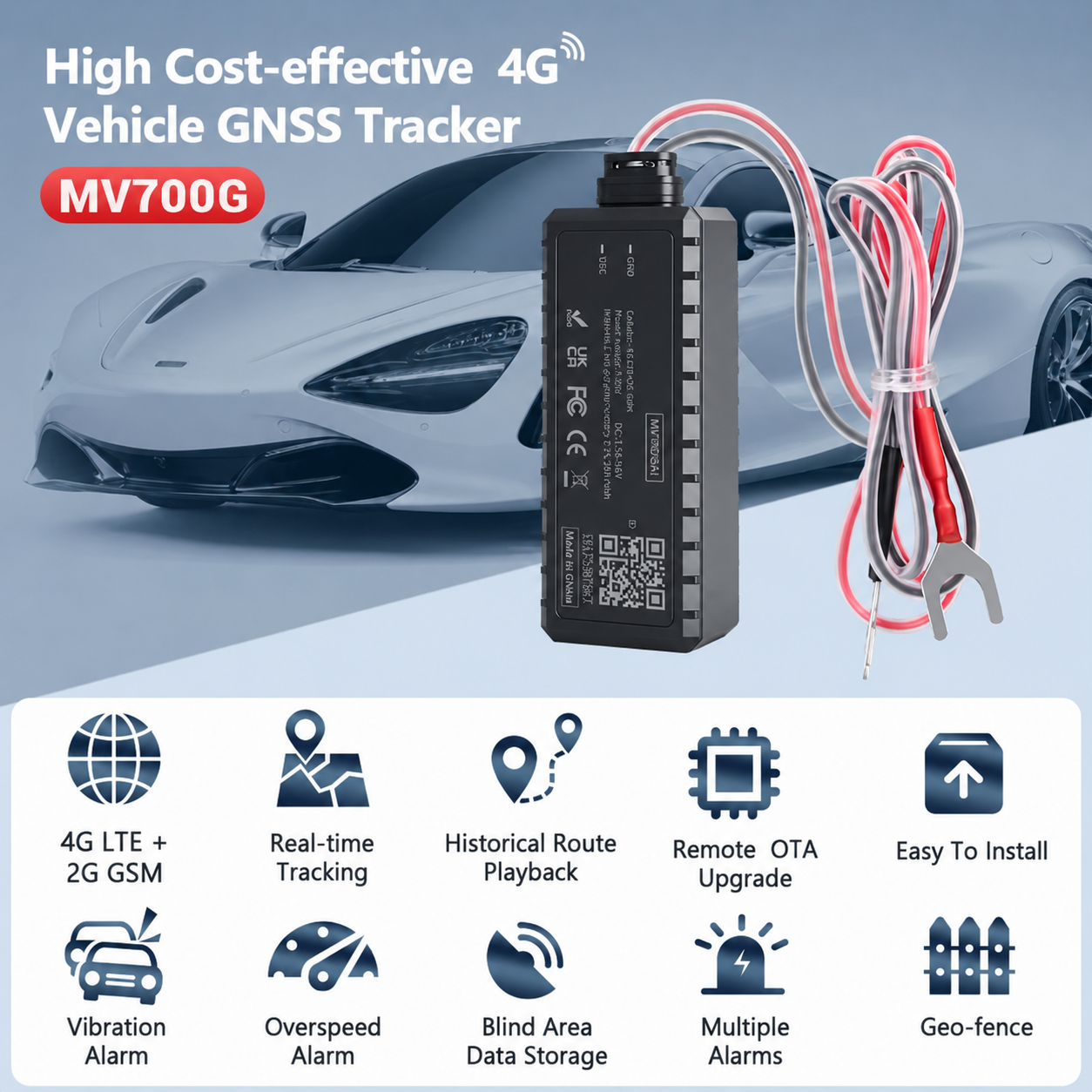
The Kendaall 4G tracker — the same hardware behind every service above, and the subject of our warranty policy.
Built for Kenya’s Roads. Engineered for the Continent.
Most GPS trackers sold in Kenya are consumer-grade devices built for stable urban environments. They lose signal in the Rift Valley, fail in the coastal humidity of Mombasa, and give inaccurate readings when a vehicle travels through the Aberdares. The Kendaall 4G tracker is an industrial-grade platform device designed from the ground up for East Africa’s real operating conditions — conditions shaped in part by connectivity gaps that persist across the wider region. Regional connectivity research from the GSMA’s Mobile Economy Africa report continues to show meaningful coverage and usage gaps outside major urban centres, which is exactly the environment a single-radio consumer tracker is least equipped to handle.
Every device carries three radio modules operating simultaneously and switches between them in under 200 milliseconds when a network path degrades. Satellite backup via Iridium ensures continuous visibility on cross-border routes through Tanzania, Uganda, and beyond where 4G coverage is inconsistent. The onboard edge processor compresses telemetry by up to 94% and continues recording complete data logs with no network at all — synchronising everything automatically when connectivity resumes. The official U.S. government resource on satellite positioning, GPS.gov, is a useful independent reference for how GNSS accuracy and augmentation actually work, for readers who want the underlying technology explained outside a vendor’s own materials.
- IP67-Rated Industrial Enclosure — fully waterproof and dust-sealed, tested to operate from −20°C to +70°C.
- Three Independent Radio Modules — 4G LTE (primary), Iridium/Starlink satellite (backup), and LoRaWAN, with automatic failover in under 200ms.
- Edge Computing + 30-Day Offline Buffer — local data processing and encrypted storage ensure no gaps in telemetry history.
- GPS + GLONASS + Galileo Positioning — tri-constellation GNSS delivers 2.5-metre accuracy under open sky.
Installation itself is non-destructive: no welding, no permanent rewiring, no alteration to the vehicle’s registered configuration. That matters because any commercial vehicle in Kenya is subject to periodic inspection and licensing checks administered by the National Transport and Safety Authority (NTSA), and a tracking installation should never be the reason a vehicle fails an inspection or raises a compliance question. It is also why the device and the installation are covered separately: hardware defects fall under the hardware warranty, while the wiring and fitting itself carries its own six-month workmanship guarantee — two different failure modes, two different remedies, both written down rather than left to memory.
The distinction between the two coverage types matters more in practice than it sounds in theory. A device that stops reporting could be a dead GNSS module (a hardware fault), a loose connector that a garage mechanic disturbed during unrelated engine work (a workmanship question, not a hardware one), or a SIM and subscription issue that has nothing to do with either (a support ticket, not a claim at all). Kendaall’s own troubleshooting sequence — covered in the free pre-check described on the warranty page — exists precisely because owners cannot usually tell these three categories apart themselves, and guessing wrong wastes a workshop visit.
Who Can See Your Fleet’s Data, and What Happens to It
A question fleet managers ask less often than they should, usually only after a driver or a competitor raises it, is what actually happens to the location, fuel, and behaviour data a tracking platform collects. The short answer for Kendaall: it belongs to the account holder, it is encrypted in transit and at rest, and access is role-based rather than open by default.
Every data transmission path between a Kendaall device and the platform runs over AES-256 encryption, the same standard used across most enterprise telematics and banking infrastructure, so intercepted traffic on an open cellular network is not readable without the account’s own keys. Within the dashboard itself, access is assigned by role — a dispatcher can see live positions and geofence alerts without necessarily seeing fuel-cost reporting meant for finance, and a driver-facing view can be scoped to show only what a specific shift or vehicle requires. Account owners decide who on their team gets which view; Kendaall does not sell, share, or expose fleet data to third parties outside the account holder’s own integrations.
For government fleets and NGOs in particular, this matters beyond convenience: donor compliance and procurement audits frequently require a demonstrable chain of custody over usage data, and a platform where any staff member can see any vehicle’s full history is a weaker audit position than one where access is explicitly scoped and logged. The tamper-evident journey logs referenced in the industries section above exist for exactly this reason — a record that cannot be quietly edited after the fact is what makes it usable as evidence in an audit or a legal dispute, rather than merely a convenience feature.
Data retention follows the same logic as the 30-day offline buffer on the device itself: once telemetry reaches the platform, historical records remain available for reporting and audit purposes for the duration of an active subscription, and export tools allow an account holder to pull their own full history at any time rather than being dependent on Kendaall to retrieve it for them.
How to Choose the Right Kendaall Configuration by Fleet Size
Not every fleet needs every layer of the platform on day one, and one of the more common mistakes in this market is a small operator paying for enterprise-grade reporting they will never open, or a large fleet under-provisioning fuel sensors and only discovering the gap after a theft goes undetected for months. The rough guide below reflects how Kendaall typically scopes a deployment during the assessment call described in the onboarding process further down this page — treat it as a starting point for that conversation, not a rigid rulebook.
1–4 Vehicles
Core GPS tracking plus fuel sensors on any vehicle where fuel is a meaningful cost line. Driver scoring and predictive maintenance are optional at this scale — the return on investment is real but smaller in absolute terms, so many single-owner operators start with location and fuel alone and add layers later.
5–25 Vehicles
This is where mobile on-site installation becomes available and where driver behaviour scoring starts paying for itself by identifying the one or two drivers responsible for a disproportionate share of fuel and maintenance cost. Full fuel monitoring across the fleet is close to a default recommendation at this size, not an optional add-on.
25+ Vehicles / Enterprise
Predictive maintenance, API integration into existing accounting or ERP systems, role-based dashboard access across departments, and a named account manager become standard rather than optional. At this scale the platform is usually justified on maintenance-cost avoidance and compliance reporting alone, before fuel savings are even counted.
Mixed fleets — a business running both lorries and boda bodas, for example — do not need to pick one service over another. The lorry and fleet tracking and motorcycle tracking services share the same dashboard and account, so a dispatch manager sees every asset class in one place rather than switching between separate logins for separate vehicle types.
One pattern worth naming directly: fleets that scope conservatively at signup and add layers later almost always end up spending more in total than fleets that provision fuel monitoring across the whole fleet from the outset, simply because the first few months of undetected fuel loss on the un-monitored vehicles usually exceed the incremental cost of covering them from day one. That is not a reason to over-buy features nobody will use — it is a reason to make fuel monitoring the one layer worth including everywhere, even on a lean initial deployment, while treating driver scoring, predictive maintenance, and API integration as the genuinely optional layers to phase in as the fleet and its reporting needs grow.
What Separates Kendaall From Every Other Tracker in Kenya
Kenya has dozens of GPS tracking providers. Most offer a device, a map, and a monthly subscription. Kendaall offers something different: an intelligence layer that turns tracking data into decisions that save money, prevent theft, and extend asset life — backed by hardware and installation terms that are published, not verbal.
Failure Prediction, Not Failure Reporting
Standard trackers tell you when a vehicle breaks down. Kendaall tells you 72 to 120 hours before it does, through vibration analysis, thermal monitoring, and OBD-II data fusion — saving three to ten times the cost of emergency roadside recovery.
No Signal Dead Zones. Anywhere.
The Kendaall device carries 4G LTE, satellite, and LoRaWAN radios simultaneously. When 4G drops, satellite takes over in under 200ms. With no network at all, the device records locally and syncs when connectivity returns.
Fuel Monitoring That Actually Works
Kendaall’s BLE fuel sensors report level every 30 seconds and apply anomaly detection that distinguishes normal consumption from unauthorised drainage. Theft alerts fire within 90 seconds of an event.
A Dashboard Built for Fleet Managers
Drill-down asset cards, exception feeds, and maintenance calendars are structured for operational decisions, not data exploration — clear answers fast, not a trained-analyst interface.
Fast Installation. Immediate Value.
Most vehicles are live on the dashboard within two hours; motorcycles in under 45 minutes. No welding, no permanent modification. Mobile installation available for fleets of five vehicles or more.
Written Warranty, Dedicated Support
Every device carries a documented hardware warranty, and our support team is based in Nairobi, available six days a week, responding to urgent alerts within two hours. Every enterprise client gets a named account manager.
None of these differentiators are meaningful in isolation — a fast installation with a weak warranty is not actually a good deal, and a strong warranty on a device with no fuel monitoring does not address where most of a Kenyan fleet’s controllable cost actually sits. The point of listing them together is that Kendaall was built as one coherent system rather than a set of features bolted onto a basic tracker after the fact, and that difference shows up most clearly in exactly the situations — a breakdown on a remote route, a disputed insurance claim, a fuel discrepancy at month-end — where a weaker platform quietly falls short.
From Sensor Signal to Dashboard Alert in Under 30 Seconds
The Kendaall platform processes over 240 data points per vehicle per minute through a four-stage pipeline that transforms raw telemetry into the operational intelligence your team actually acts on. Each stage exists to answer a specific question — what happened, how do we get it off the vehicle, what does it mean, and what should a human do about it — rather than simply piling up data for its own sake.
Capture
GPS coordinates, fuel level, engine temperature, RPM, speed, accelerometer data, and OBD-II fault codes collected continuously.
Transmit
The multi-network radio module selects the optimal path in real time; edge compression cuts bandwidth by up to 94%.
Analyse
Anomaly detection, fuel theft pattern matching, driver scoring, and predictive maintenance algorithms run simultaneously.
Alert & Act
Intelligence surfaces via dashboard, SMS, and automated data feeds — work orders and alerts trigger on business rules.
No Signal Dead Zone. No Data Gap. No Excuses.
Kenya’s road network crosses highland forest, Rift Valley escarpments, remote northern corridors, and cross-border routes where no single network operator provides consistent 4G coverage. Kendaall designed its connectivity architecture around this reality. A centralised connectivity management chip monitors signal quality continuously and executes seamless automatic failover in under 200 milliseconds when a primary path degrades.
This is a deliberate design choice rather than a marketing checkbox, because the failure mode of a single-network device is invisible until it matters most: a tracker with only 4G looks identical to one with three radios right up until a vehicle enters a coverage gap, at which point the single-network device simply stops reporting with no record of what happened in between. A fleet manager relying on that device has no way to distinguish a genuine emergency from an ordinary dead zone during the exact window when the distinction matters most — which is the practical argument for redundant connectivity over a cheaper single-radio alternative, independent of any brand preference.
- Sub-200ms automatic network failover with zero data loss
- 30-day local telemetry buffer on encrypted industrial flash storage
- AES-256 encryption on all data transmission paths
- Satellite backup covering cross-border routes in East Africa
- 5G-ready hardware module for future network upgrade compatibility
The Real Cost of Fuel Theft and Unplanned Downtime in Kenya
Two cost categories dominate the total cost of operating a commercial fleet in Kenya, and both are largely invisible without sensor-level data: fuel loss and unplanned downtime.
Fuel loss happens through two channels — inefficient driving (excess idling, harsh acceleration, poor route selection) and outright theft (siphoning at stops, meter tampering, receipt fraud). Because pump prices in Kenya are set through a monthly regulatory formula published by the Energy and Petroleum Regulatory Authority, an operator cannot negotiate the price of fuel — the only variable within their control is how much of it actually reaches productive use versus how much disappears between the pump and the destination. A fleet with no fuel-level telemetry has no way to distinguish “the vehicle used more fuel because of traffic and terrain” from “someone opened the tank at a stop.” Kendaall’s fuel sensors exist specifically to remove that ambiguity.
Unplanned downtime is the second major leak, and it compounds fuel loss rather than sitting apart from it: a lorry that breaks down mid-route on the Nairobi–Mombasa corridor does not simply stop earning revenue — it triggers recovery costs, cargo delay penalties, and often a rushed, more expensive repair than the same fault would have required if caught early. Predictive maintenance exists to convert an unplanned breakdown into a scheduled service appointment, and the lead time Kendaall’s models typically provide — 72 to 120 hours — is enough for most fleet managers to route a vehicle to a workshop before it fails on the road rather than after.
There is also a third, quieter cost category that fleet owners tend to discover only after a claim: insurance. Vehicles with a documented behaviour and maintenance record are generally easier to defend in a claims dispute than vehicles with no data trail at all, since the insurer is working from driver testimony rather than a timestamped log of speed, braking, and location. That is not a guarantee of a lower premium, but it is a materially stronger position when a claim is contested.
Neither of these cost categories shows up as a single line item on a balance sheet. They are distributed across fuel budgets, maintenance budgets, insurance premiums, and missed delivery penalties — which is exactly why they persist unaddressed in fleets that rely on manual logs or driver self-reporting instead of continuous sensor data.
A Simple Way to Estimate the Return Before You Commit
Fleet owners evaluating whether telematics is worth the monthly subscription tend to get a clearer answer from a rough back-of-envelope calculation than from a vendor’s marketing percentage. Start with the fleet’s total monthly fuel spend — most Kenyan operators know this number precisely, since it is usually their largest single variable cost. Apply a conservative 10–15% assumption for unaccounted loss through a combination of theft and inefficient driving, which sits below the 18–24% recovery range typically reported by Kendaall’s own fuel monitoring clients. That figure, compared against the monthly subscription and one-time installation cost for the fleet size in question, is usually enough to show whether the investment clears its own cost within the first few months — before predictive maintenance savings, reduced insurance friction, or recovered stolen assets are even factored in. A solutions specialist can run this calculation against a fleet’s actual numbers during the free demo referenced at the bottom of this page.
Precision Tracking Intelligence Across Every Sector That Moves
Kendaall’s platform adapts to the operational rhythms, regulatory requirements, and asset types specific to each industry — delivering context-relevant intelligence rather than generic location data. The same underlying device and dashboard support four distinct use cases below, each configured differently because the questions a construction site manager needs answered are not the questions a cross-border freight operator needs answered.
Logistics, Freight & Commercial Transport
Cross-border lorry operators, freight forwarders, and matatu fleet owners face the most complex tracking requirements: multi-driver rosters, multi-border routes, fuel accountability, and cargo security. Driver behaviour scoring identifies who is responsible for excess fuel consumption; route compliance flags corridor deviations; OBD-II integration enables maintenance scheduling based on actual engine condition. Satellite connectivity ensures visibility on cross-border routes into Tanzania, Uganda, and Rwanda. See the full lorry and fleet tracking service for configuration details.
24%
Average fuel savings for lorry fleet clients in Year 1
42%
Reduction in unplanned vehicle stoppages
96hr
Maximum predictive maintenance lead time
2hr
Maximum installation time per lorry
Heavy Construction & Infrastructure Projects
Construction fleets deploy across dynamic multi-kilometre worksites where equipment theft, unauthorised use, and idle time inefficiency are the biggest controllable cost drivers. Kendaall provides geofencing with active theft deterrence, utilisation analytics separating productive cycles from idle hours, and predictive maintenance for hydraulic systems. Because a construction site’s perimeter often shifts as work progresses, geofence boundaries are adjustable from the dashboard rather than fixed at installation, which matters on a project running for months rather than a static depot address.
22%
Equipment idle time reduction
0
Theft incidents with active geofencing
15min
Average theft alert response time
8mo
Average ROI payback period
Last-Mile Delivery & Boda Boda Fleets
E-commerce fulfilment, pharmacy delivery, and food logistics businesses rely on large motorcycle and light vehicle fleets operating across dense urban environments with high rider turnover. Kendaall provides real-time location for delivery proof, zone compliance, and driver behaviour monitoring for insurance purposes, with fleet-level dashboards showing rider status and performance scores. This is the same hardware behind our motorcycle and boda boda tracking service.
18%
Delivery time improvement
100%
Delivery verification accuracy
60sec
Zone violation alert response time
30%
Reduction in insurance claims
Government Fleets, NGOs & Development Organisations
Government vehicle fleets and NGO field operations require transparent utilisation reporting, donor compliance, and verifiable journey records. Kendaall provides tamper-evident journey logs, automated mileage reports, and out-of-hours usage alerts — with satellite connectivity for remote field environments where network infrastructure is unreliable. The role-based data access described in the security section above is particularly relevant here, since a procurement or donor audit typically wants to see who had visibility into which vehicle’s records, not just the records themselves.
100%
Journey audit trail coverage for donor reporting
Zero
Manual mileage log entries required
Sat
Satellite backup for off-grid field deployments
24hr
After-hours usage alerts
Key Terms in Fleet Telematics and GPS Tracking
Fleet telematics conversations get confusing quickly because the terminology overlaps with automotive engineering, telecommunications, and IoT hardware. Defining each entity clearly here — rather than assuming it — is what lets the rest of this page use these terms precisely instead of loosely, and it is what lets a search engine understand which distinct concepts this page actually covers.
- GNSS (Global Navigation Satellite System)
- The umbrella term for satellite positioning networks, including GPS (United States), GLONASS (Russia), and Galileo (European Union). Devices that combine signals from more than one constellation, as Kendaall’s hardware does, achieve more reliable positioning in urban canyons, dense forest cover, and mountainous terrain than single-constellation devices. GPS.gov maintains an independent technical explainer on how this works.
- Telematics
- The combined use of telecommunications and vehicle informatics — sending and receiving data about a vehicle’s location, condition, and usage between the vehicle and a central platform.
- Geofence
- A virtual boundary drawn around a real-world area — a depot, a delivery zone, a construction site perimeter — that automatically triggers an alert when a tracked asset crosses it.
- OBD-II / CAN-bus
- On-Board Diagnostics (second generation) and Controller Area Network bus are the standardised interfaces most vehicles use to expose engine fault codes, RPM, coolant temperature, and other live performance data to connected devices.
- BLE Fuel Sensor
- A Bluetooth Low Energy fuel-level sensor installed inside a tank that reports readings wirelessly at fixed intervals, without the driver needing to physically dip or measure the tank.
- Predictive Maintenance
- A maintenance strategy that uses sensor data — vibration, temperature, engine fault codes — and pattern recognition to forecast a likely component failure before it happens, rather than servicing strictly on a fixed calendar schedule.
- Driver Behaviour Scoring
- A composite score derived from accelerometer and GPS data that quantifies harsh braking, rapid acceleration, speeding, cornering force, and idle time for an individual driver over a given period.
- Hardware Warranty vs. Installation Workmanship Guarantee
- Two separate coverage types that owners frequently conflate. The hardware warranty covers device defects — see the full hardware warranty policy. The workmanship guarantee covers the wiring and fitting work itself, independent of whether the device is faulty.
- Engine Immobilisation
- A remote command, issued from the dashboard or by SMS, that interrupts a vehicle’s ignition or fuel circuit to prevent it from being started or driven — used mainly for theft recovery, typically only enabled once a vehicle is confirmed stationary for safety reasons.
- Edge Computing (in a tracking context)
- Processing and storing telemetry data locally on the device itself, rather than relying solely on a live network connection, so a vehicle continues logging accurate position and sensor data even in a total signal blackout.
Basic GPS Tracker vs. Kendaall Fleet Telematics
Because “GPS tracker” is used loosely across the Kenyan market, it helps to see the two product categories side by side rather than take a provider’s word for which one they are selling.
| Capability | Basic GPS Tracker | Kendaall Fleet Telematics |
|---|---|---|
| Live location on a map | Yes | Yes |
| Fuel level monitoring & theft alerts | No | Yes |
| Engine diagnostics (OBD-II / CAN-bus) | No | Yes |
| Driver behaviour scoring | No | Yes |
| Predictive maintenance alerts | No | Yes |
| Multi-network failover (4G + satellite + LoRaWAN) | Rarely | Yes |
| Offline data buffering | Limited or none | Up to 30 days |
| Remote engine immobilisation | Rarely | Yes |
| Automated compliance & audit reporting | No | Yes |
| Written hardware warranty | Varies by seller | Yes — full policy |
A basic tracker is not a wrong choice for every use case — a small operator with a single vehicle and no fuel accountability concerns may not need the full telematics layer. But for any fleet where fuel cost, driver accountability, or maintenance planning matters, the location-only product leaves the majority of the potential return on investment on the table.
A Buyer’s Checklist for Choosing a GPS Tracking Provider in Kenya
Whichever provider a business chooses, these are the questions worth asking before signing a contract — because the answers determine whether the deployment actually pays for itself.
- Does the device support multi-network failover? A single-radio device is only as reliable as the weakest network coverage on the routes it travels.
- What happens to data when there is no signal at all? Ask specifically about the offline buffer duration and whether synced data preserves full time-series accuracy.
- Is fuel monitoring included, or a paid add-on? Fuel accountability is usually where the majority of the return on investment comes from — confirm it is part of the core offering, not an upsell.
- How is installation performed, and does it alter the vehicle? Non-destructive installation protects the vehicle’s warranty and its standing with periodic inspection requirements.
- What is the alert response time for theft or unauthorised movement? A geofence alert that arrives twenty minutes late is of limited use for asset recovery.
- Can the platform export data to existing accounting or fleet software? Manual re-entry of fuel and mileage data defeats much of the purpose of automated monitoring.
- Is there a written hardware warranty, and what voids it? Ask to see the actual policy, not a summary — Kendaall’s own warranty page is a reasonable template for what a provider should be willing to put in writing.
- Is local support based in Kenya, with real response-time commitments? A device is only as useful as the support behind it when something goes wrong.
What Kenya’s Fleet Managers Say About Kendaall
“We were losing fuel we could not account for across our lorry fleet on the Nairobi–Mombasa run. Within three weeks of Kendaall installation we identified two drivers systematically draining tanks. The fuel alerts paid for two years of subscription in the first month.”
James M.
Fleet Manager, Kenyan Logistics Company
“I run a boda boda delivery business with 34 riders across Westlands and Karen. Now I get instant alerts when a rider leaves the service area and can immobilise bikes remotely. We have not lost a single bike to theft since deployment.”
Faith W.
Operations Owner, Nairobi Delivery Business
“Our construction fleet had two generators stolen from site within six months. After geofencing every site perimeter, an attempted theft triggered an alert in under three minutes and we recovered everything. The difference is night and day.”
Patrick O.
Operations Director, East African Construction Group
From Enquiry to Live Dashboard: The Onboarding Process
Fleet managers evaluating a new provider often want to know what the first few weeks actually look like, beyond the sales conversation. Here is the sequence Kendaall follows for a typical deployment.
Assessment & Quote
A solutions specialist reviews fleet size, vehicle types, and priority pain points, then proposes a device and sensor configuration with a firm quote.
Installation Scheduling
Certified installers are scheduled at your premises or ours. Fleets of five or more vehicles qualify for mobile on-site installation.
Device Fitting & Testing
Non-destructive installation, live signal verification, and fuel sensor calibration where applicable, completed in under two hours per vehicle.
Dashboard Training
Fleet managers and dispatchers receive hands-on dashboard training, alert configuration, and reporting setup tailored to their workflow.
Answers to What Buyers Ask First
GPS tracking decisions involve real money and operational commitment. These are the questions Kenya’s fleet managers, logistics directors, and small business owners ask most before deploying Kendaall — answered directly, without sales language.
What is GPS vehicle tracking and how is it different from fleet telematics?
GPS vehicle tracking refers specifically to using satellite positioning to determine and report a vehicle’s location. Fleet telematics is the broader discipline that layers fuel level, engine diagnostics, driver behaviour, and maintenance data on top of that location, turning a map dot into an operational decision-making tool.
How much does GPS vehicle tracking cost in Kenya?
Kendaall Tracking offers GPS tracking packages starting from KSh 3,500 for device installation, with monthly subscription plans covering live tracking, alerts, and full dashboard access. Pricing scales with fleet size, feature requirements, and whether fuel sensors are included. We offer volume pricing for fleets of five vehicles or more — contact our team for a tailored quote.
How does fuel monitoring work with a GPS tracker?
Kendaall installs BLE-connected fuel level sensors directly inside the vehicle or equipment tank. These sensors transmit live fuel level readings every 30 seconds. The system detects sudden, unexplained drops indicative of siphoning and sends an instant alert regardless of the vehicle’s location, while also providing accurate consumption data per kilometre for cost-per-route analysis.
Can I track motorcycles and boda bodas with Kendaall?
Yes. Kendaall supplies compact, concealable GPS units designed for motorcycles and boda bodas, drawing power from the bike’s own electrical system. Features include ignition-event logging, geofence alerts within 60 seconds of a boundary violation, and remote engine immobilisation via dashboard or SMS command.
Does the tracker work when there is no network coverage?
Kendaall devices continue operating normally with no network coverage. The edge computing module stores up to 30 days of full-resolution position and sensor data locally in encrypted flash storage, synchronising automatically when connectivity resumes with complete time-series integrity. Satellite backup via Iridium extends live tracking outside East African 4G coverage areas.
How long does GPS tracker installation take?
Standard installation on a car, van, or lorry takes between 45 minutes and two hours depending on device type and whether fuel sensors are fitted simultaneously. Motorcycle installation takes under 45 minutes. Installation is non-destructive — no welding, drilling, or permanent modification required. Mobile fleet installation is available for fleets of five vehicles or more.
What is the difference between basic GPS tracking and Kendaall fleet telematics?
A basic GPS tracker shows vehicle location and speed. Kendaall fleet telematics adds fuel level monitoring and theft detection, driver behaviour scoring, engine diagnostics via OBD-II, predictive maintenance alerts 72–120 hours before failure, geofencing with configurable response rules, automated compliance reporting, and a full analytics dashboard for benchmarking fleet performance over time.
Is GPS tracking installation compliant with Kenyan road transport regulations?
Kendaall’s installation process is non-destructive and does not alter a vehicle’s registered specifications, so it does not interfere with routine inspection or licensing processes overseen by the National Transport and Safety Authority. Commercial and public service vehicle operators should still confirm any sector-specific tracking requirements that apply to their particular vehicle class.
Can Kendaall integrate with existing fleet management or accounting software?
Kendaall’s platform exposes fuel, mileage, and maintenance data through exportable reports and an API layer that can feed into common fleet management, accounting, and enterprise resource planning systems, reducing duplicate manual data entry for finance and operations teams.
What happens if a tracked vehicle is stolen?
If a tracked vehicle or motorcycle moves outside its assigned geofence or its ignition is triggered outside authorised hours, Kendaall sends an immediate alert to the fleet manager. Devices with immobilisation capability allow authorised users to remotely disable the ignition, and the live map view supports coordination with recovery efforts and law enforcement.
Does hardware bought from Kendaall come with a warranty?
Yes. Every GPS tracker, fuel sensor, dashcam, and accessory sold or fitted by Kendaall carries a documented hardware warranty, separate from the installation workmanship guarantee on the fitting itself. Coverage periods by product class, what voids coverage, and the exact claims process are set out in full on our hardware warranty policy page.
Who can see my fleet’s location and driver data once it’s on the Kendaall platform?
Access is role-based and controlled entirely by the account holder. A dispatcher, a finance user, and a driver-facing view can each be scoped to see only what their role requires, and Kendaall does not sell or share fleet data with third parties outside the account’s own integrations. All transmission is AES-256 encrypted.
Do I need fuel monitoring, driver scoring, and predictive maintenance all at once, or can I start smaller?
You can start with core GPS tracking and add layers later. In practice, fuel monitoring is worth including from day one for any fleet where fuel is a meaningful cost, while driver behaviour scoring and predictive maintenance tend to show clearer returns once a fleet reaches five or more vehicles. A solutions specialist can scope this to your fleet size during the free assessment call.
What is the difference between the hardware warranty and the installation workmanship guarantee?
The hardware warranty covers defects in the device itself — electronics, casing, sensors — for a set period from purchase or installation, detailed on the warranty page. The workmanship guarantee is separate and covers the wiring and fitting work performed by Kendaall’s technicians, independent of whether the device itself is later found to be faulty.
Can Kendaall track equipment and generators, not just vehicles?
Yes. The same fuel-sensor and GPS hardware used across vehicle services extends to stationary and portable assets — generators, water pumps, containerised equipment, and construction machinery — reporting fuel level, location, and, where fitted, tamper alerts through the same dashboard as the rest of a fleet.
Your Vehicles Are Moving. Your Intelligence Should Be Too.
Schedule a 30-minute platform demonstration with a Kendaall solutions specialist. We will walk you through a live tracking and fuel monitoring scenario matched to your fleet type, and build a preliminary cost-saving estimate based on your current vehicle count and operational profile. No obligation, no sales pressure — just clarity on what Kendaall can do for your specific operation.
Book a Free Demo Platform Overview
+254 105 152 896 · sales@kendaalltracking.co.ke · 35644 Kasarani Mwiki Road, Nairobi 00100